Crêtes et Monuments de Mortain
Départ place du château. Prendre à gauche de la Place après l'ancienne "Caisse d'Epargne" le chemin à droite qui mène vers la Petite Cascade. Au Rocher de l'Aiguille, continuer tout droit et suivre le cheminement. Tout en haut, au niveau du Pont du Diable, prendre à droite vers la Grande cascade. Sur la rue du pont Bossard, prendre à gauche, puis après l'église du Neufbourg, prendre à droite. A l'intersection de la route, prendre à gauche, puis à gauche vers la Grande cascade. Après la passerelle, suivre le cheminement en face et remonter vers la rue de l'Abbaye Blanche. Emprunter le passage protégé pour traverser et continuer à gauche.
Prendre à gauche vers la rue du Vieux Bourg et rejoindre la D977. Franchir le pont (la voie verte passe en dessous), 1ère à gauche, puis à droite.
Au Grand Clos, prendre à droite : vous arriverez sur la route de Romagny. Rejoindre à droite le carrefour de la Tête à la Femme. Traverser le rond-point (attention à la circulation !), se diriger sur la D 246, puis prendre le chemin à gauche. Passer Belle-Eau et continuer sur la route en face.
Au carrefour, poursuivre à droite vers Beauvallon. Suivre le chemin, passer le lieu-dit La Lande de Beausoleil et descendre à gauche jusqu'à la voie verte. Continuer tout droit. Franchir la rivière de la Cance, traverser la D46, puis déboucher sur la D157. Prendre à gauche pour atteindre la Résidence Louis Hourdin. La contourner par la gauche et poursuivre sur le chemin. Vous passerez à proximité de la cote 314, parcours histoire sur la seconde guerre mondiale à voir sur la droite.. Vous arriverez au parking de la Petite Chapelle. Rejoindre la Petite Chapelle pour atteindre la table d'orientation qui est derrière (vue exceptionnelle). A gauche de l'entrée de la Petite chapelle, prendre le chemin qui redescend. Vous arriverez au cimetière. Prendre à droite, puis à gauche vers la rue de Versailles. Au bout de la rue, prendre à droite, rue de la 30ème division, puis rejoindre à gauche La Collégiale (le plus ancien édifice de la Ville). Descendre par la rampe passant devant le parvis, puis rejoindre la Place du Château par la rue du Bassin.
During this easy walk, despite its steep slope, you will discover the Mortainais region and its many legends. The legend of the Devil's Bridge tells how the people of Mortain cunningly refused to give in to the orders of Belzebuth who had built the bridge. The devil in anger, pushed the rocks against the bridge what you can still see today
Remarkable points on the circuit :
0 - Departure from the castle square with a commemorative stele recalling the conquest of England by Robert de Mortain in the XIth century with his half-brother William the Conqueror "I Robert by the grace of God Count of Mortain went to war carrying the standard of St Michael - 1066"
1 - The collegiate church of Saint-Evroult is made of red stones, dated from the 13th century. It is the oldest monument in Mortain. There are still some vestiges of the Romanesque period, in particular a superb door which recalls the memory of Saint Firmat.
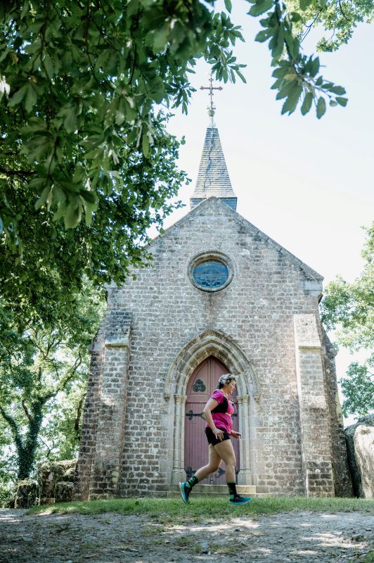
2 - Saint-Michel Chapel which offers a panoramic view of Mont-Saint-Michel in good weather and which has been known since the Middle Ages by pilgrims who saw it as the goal of their journey. The monument only dates from the 19th century. See the orientation table.
3 - You cross the old railway line which went to Vire. It was probably linked to the old iron mine, on your left. Mines were exploited in Lower Normandy as early as the Gallo-Roman era..
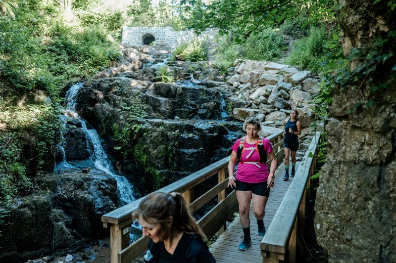
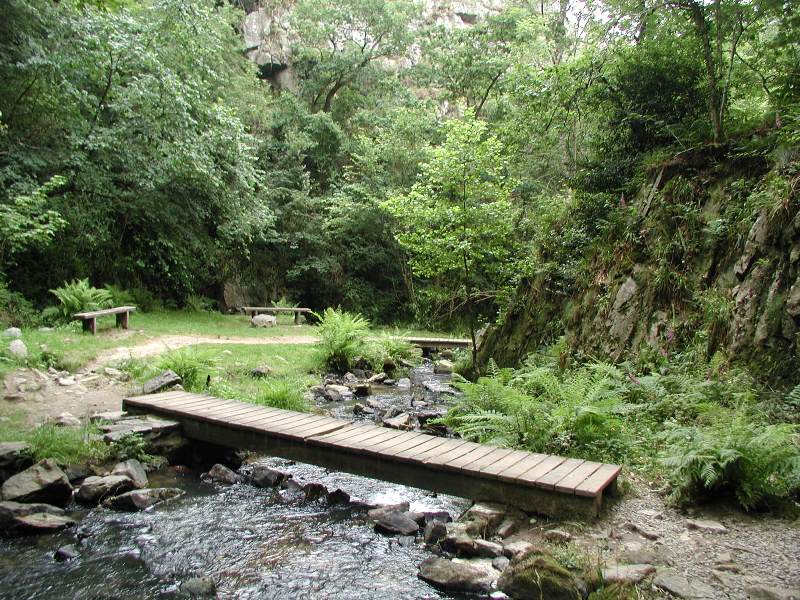
4 - The small waterfall, shaded and green, is perfect for a walk. Carved out by the Cançon river, the deep gorge is easy to walk through thanks to its fitted out stairs. Freshness, rustling water and birdsong inspire tranquility
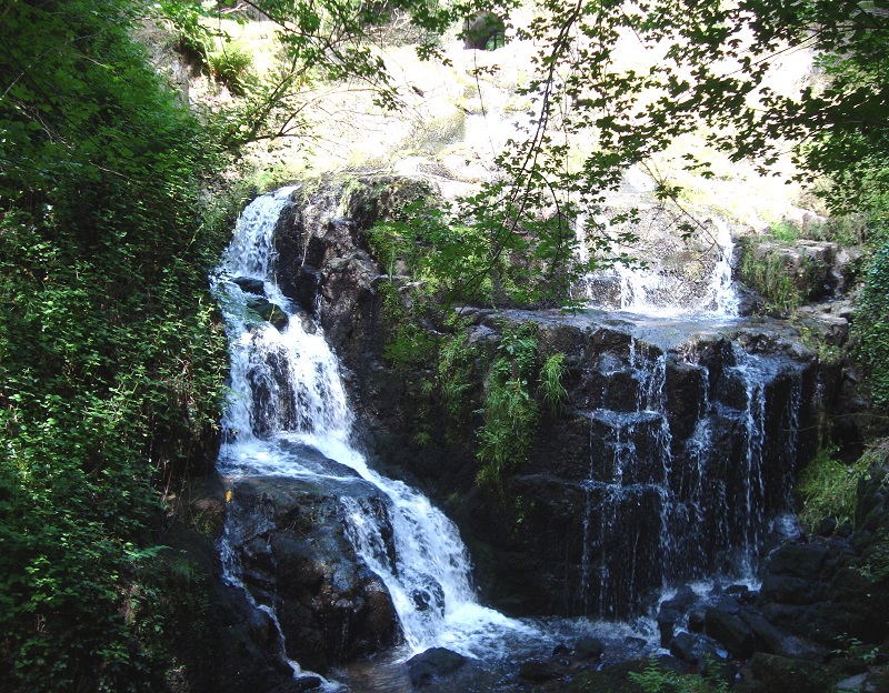
5 - The big waterfall, make the round trip (100m)
On the Armorican sandstone reliefs, the waters of the Cance fall from about twenty meters. The vegetation is dense. Will you see the rhododendrons in flower?
6- Rocher de l'aiguille : climbing site which offers 80 routes from 5 to 35 m high. There is something for everyone, with difficulty levels ranging from 2 to 7
Remarkable points in the vicinity:
Abbaye Blanche, Mortain, founded in 1120
Mortain is the gateway to the Normandy-Maine Regional Natural Park, which extends from Lower Normandy to the Pays de Loire, on 235 000 hectares. It covers 149 communes and 4 departments.
Fosse Arthour, Saint-Georges-de-Rouelley, a wild and beautiful natural site where the beautiful legend of King Arthour and his wife takes place.
The Enchanted Village, Bellefontaine, on the theme of Fairy Tales and which today also offers accrobranche, automatons, tyroliennes and other attractions.
Localisation & itinéraire
Informations pratiques
Mise à jour : 2026-04-24 00:00:00